

Warrabkook Farm - Precision Farming Survey
Large Scale Drone Farming Solution
BACKGROUND
Growth Farms - A privately owned investment management company that has achieved a long-term net return of 10.4% pa to investors. It was founded in 1999 by a small group of successful Australian farmers and has since grown to manage over A$400 million of agricultural investments for a global network of high net worth individuals, family offices, and institutional clients.
Growth Farms’ core philosophy is to manage sustainable, efficient, and profitable agriculture operations.
PROJECT
Growth Farms manage a farm near the town of Hamilton. Warrabkook is situated on 250 hectares of land predominately used for sheep farming. Their object was to bring new insight into their farming practices using technology.
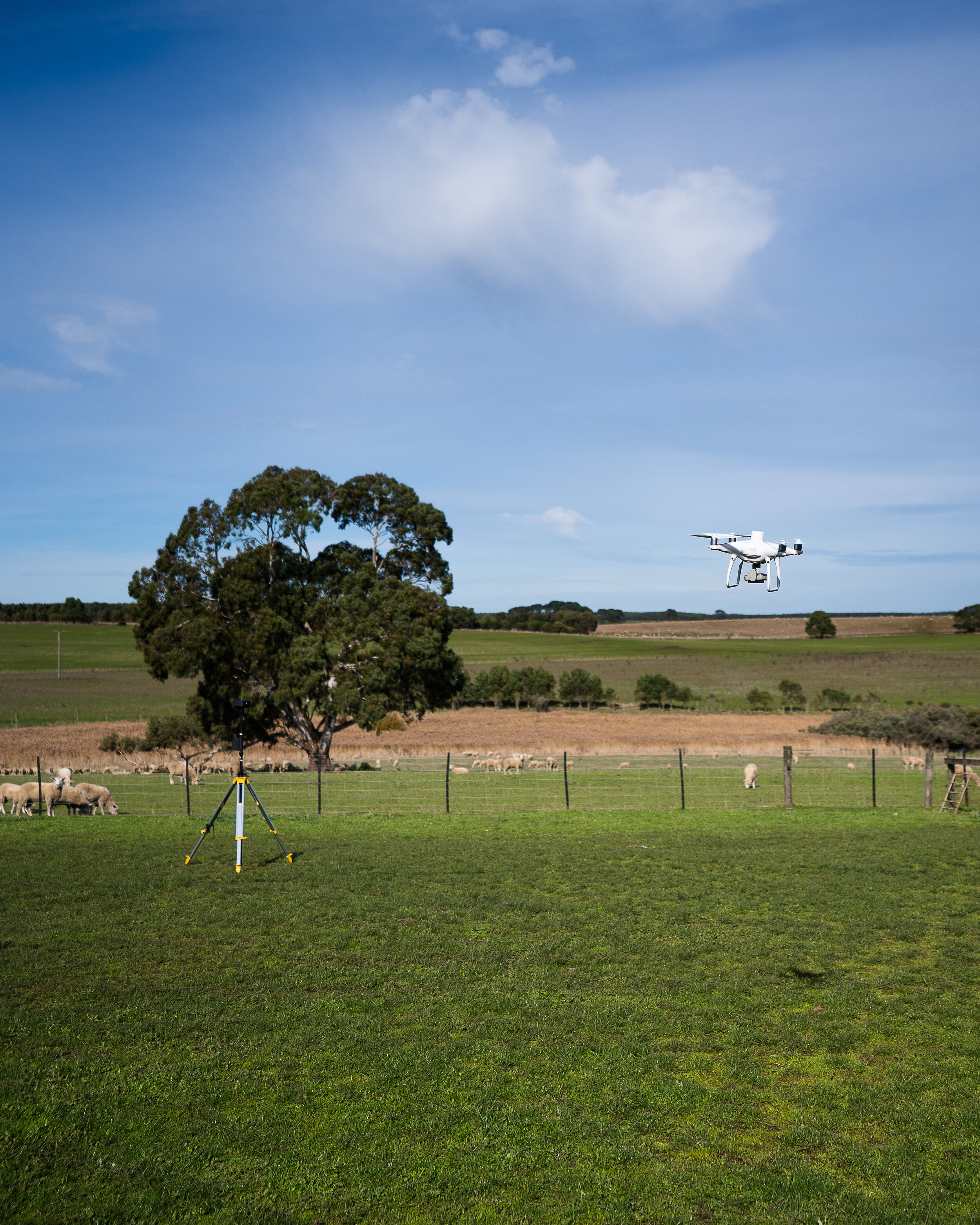
DJI P4 RTK begins surveying over 250 hectares of land aided by RTK Base station.
PROBLEM:
Farmers spend many hours of their day doing routine checks on livestock, equipment, and feed. Warrabkook - being over 250 hectares of land means many hours getting to and from places.
others potential issues
Poor soil conditions
Erosion
Broken fence and/or leaking water pump
Lack of precision with grass volume
Poor health livestock
General maintenance
To determine the health of soil conditions, a farmer can only access via 4WD in dry conditions. Otherwise, walk across his farmland to ensure that paddocks are not nutrient deficient.

RTK Base station for farming scan

DJI Phantom 4 ready for take off

XM2 EARTH employee working closely with farmer
XM2 EARTH SOLUTIONS
XM2 EARTH was able to bring in smart solutions via using the Phantom 4 RTK and Phantom 4 RTK multispectral drones. 2 Pilots arrived on location and were able to set up and take off within 20 minutes. Equipped with a DJI RTK Base station. Our pilots are able to extract extremely accurate GPS points on the drones as they capture data from above. With automated flights, the DJI drone covered the entire farm efficiently. Only taking 1 day of capturing time. The data captured leaves the farmers, managers, and other stakeholders with valuable data that lasts.
What did XM2 EARTH achieve?
Our pilots were able to deliver
Orthomosaic image of the 250-hectare farm.
Software is given to the farmers, managers, and other stakeholders to make annotations and other references.
Multispectral imagery of the entire farm, showcasing chlorophyll levels (sunlight absorption of plant health)
Accurate grass volumetric data
Historial reference
Data needed for restoration actions

Multispectral Capture of one paddock

3D Twin of farm