


SERVICES


Asset Inspection
Drones have access to tall, large scale assets, giving XM2 Earth the capabilities to bring valued information that is cost-effective, safer, and more time-efficient. XM2 EARTH has thermal, LiDAR and aerial solutions.

Surveying & Mapping
Drones provide the ability to capture on-demand maps for a fraction of the cost of traditional approaches using manned aircraft, and at a much higher resolution than satellites. XM2 EARTH has software that makes it extremely easy to store, view and manipulate your data.
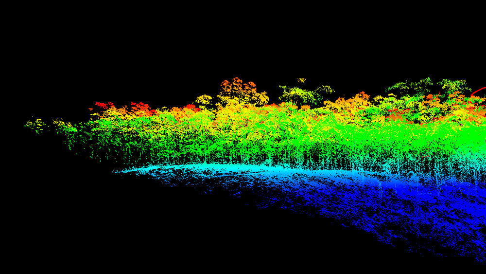
LiDAR
LiDAR (Light Detection and Ranging) is a remote sensing method that uses light measure ranges to the Earth.
XM2 EARTH can scan the environment to create exceptional 3D models in dense areas

Specialist Sensors & Services
We carry a wide range of payloads to complete an array of applications. We specialise in adapting your required sensor to any custom platforms be it ground air or sea.

Consulting
XM2 EARTH will cater to any solutions specific to your problem. XM2 EARTH caters to solutions big or small. With our in-depth knowledge of industry and technologies, we can help you find the best option.

Custom Manufacturing & Design
XM2 EARTH’s foundations are in our custom design and manufacturing. Giving us the unique ability to develop custom solutions via our sensors, software, and hardware.

NEWS & CASE STUDIES


Industrial Aerial & Ground Control
INSURED
RELIABLE
CASA APPROVED
IN-HOUSE ENGINEERS & WORLD-CLASS PILOTS